Satellite analytics · Munich
We turn satellite measurements of farmland into two things: settlement-ready damage evidence for crop insurers, and water and nutrient decisions for large irrigated farms. One platform, two businesses.
The same pipeline that measures a damaged field for an insurer measures water stress for a farm manager. Pick the side you are on.
For crop insurers
After a storm every policyholder calls on the same day, and no adjuster team can be in two places at once. We measure the damage from above and return it as hectares you can settle on — within days, and regardless of cloud cover.
For farms & irrigation
A pivot is irrigated as one block, but it does not dry as one block. OMEGA measures actual evapotranspiration, salinity and canopy stress per zone, so water goes where the crop needs it and nowhere else.
Figures come from commercial deployments and state the conditions they were measured under. Results vary by crop, soil and irrigation system. Detailed case evidence is available to prospective customers under NDA.
Comprehensive tools for modern precision agriculture, from satellite monitoring to automated irrigation control.
Early identification of crop issues using Vegetation analysis and satellite imagery.
Real-time tracking of crop health, growth stages, and seasonal progress.
Smart water optimization with evapotranspiration calculations and VRI.
Complete farm digitization with calendars and team collaboration.
16-day predictions with ETo calculations using scientific standards.
Real-time pivot monitoring with instant alerts and schedule adjustments.
Fertilizer-based nitrogen deficiency detection using hyperspectral imagery.
Comprehensive view of all farm metrics for quick decisions.
Split your farm into 4 quarters for higher accuracy analysis. Our water stress analysis identifies problem zones instantly, enabling targeted interventions.
Each quarter gets individual health scores and stress indicators.
Measured across 1,000 ha over a full season, at maintained yields. Target specific zones instead of uniform field application.
Identify issues before they spread across the entire field.
Detect anomalies on the spot with just a few clicks using rapid Vegetation analysis and satellite imagery comparison.
Compare detected anomalies against healthy reference areas with significant index deviation alerts and Vegetation trend analysis.
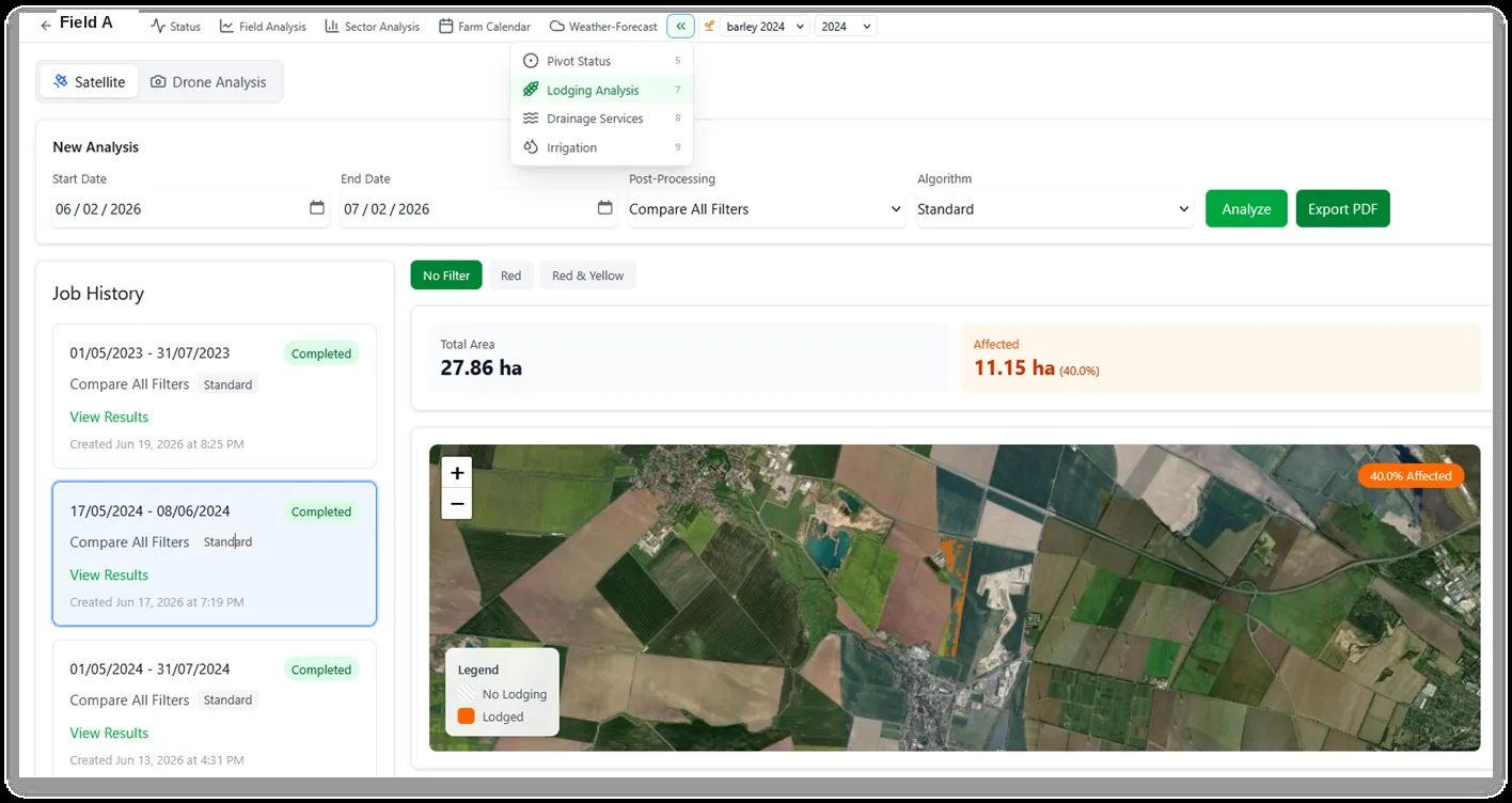
Quickly assess crop damage with severity classification - from low to high severity areas with exact hectare measurements.
Monitor soil moisture, crop growth, leaf moisture, and temperature with real-time trend visualization.
Fertilizers analysis reveals areas with different nitrogen needs even when crops appear healthy in standard Vegetation views.
Platform detects irrigation in internal areas without crops, providing clear visualization of water waste locations and identifying resource inefficiencies.
Identify over-irrigation zones using Vegetation and soil moisture analysis.
Measured across 1,000 ha over a full season, at maintained yields.
Explore our comprehensive suite of precision agriculture tools designed for maximum efficiency.
Identify sustainable practices that conserve water while maintaining crop health.
Measure actual ET rates per quarter to optimize water distribution.
Advanced VRI maps for precise water application across field zones.
Monitor and control pivots remotely with real-time status updates.
Schedule and track all farming activities with team collaboration.
At-a-glance view of all critical farm metrics and irrigation plans.
16-day weather predictions for standard evapotranspiration calculations for precision irrigation planning.
Join the digital agriculture revolution. Get complete visibility, improved efficiency, and sustainable practices with OMEGA.
OMEGA is incubated at ESA BIC Bavaria and supported by EIT Food. Patent filing funded through WIPANO by the German Federal Ministry for Economic Affairs and Climate Action. Co-funded by the European Union.